

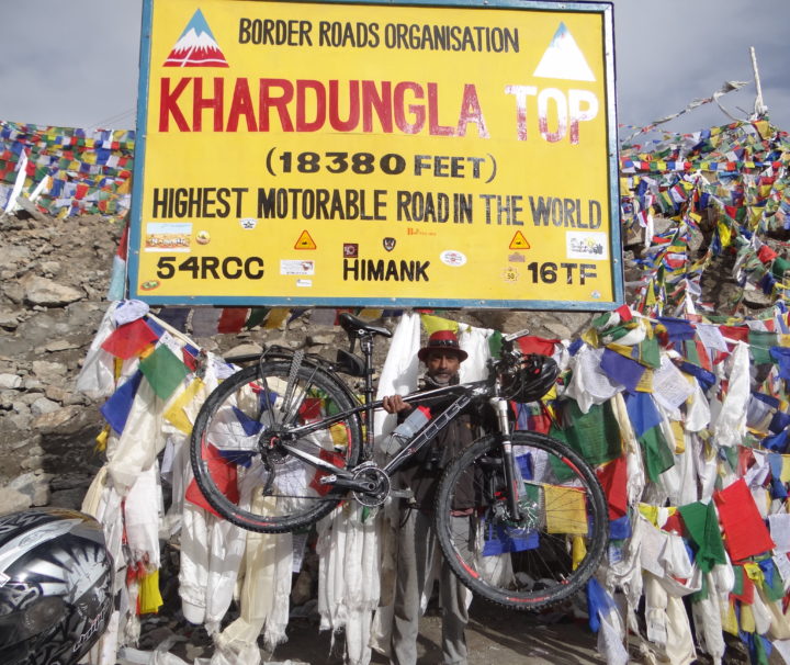
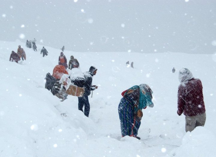
HIGH PASSES OF LADAKH
Ladakh (“land of high passes”) is a region in Indian state of Jammu and Kashmir that currently extends from the Kunlun mountain range to the main Great Himalayas to the south, inhabited by people of Indo-Aryan and Tibetan descent.It is one of the most sparsely populated regions in Jammu and Kashmir and its culture and history are closely related to that of Tibet. Historically, the entire upper Indus Valley, the remote Zanskar, Lahaul and Spiti to the south, much of Ngari including the Rudok region and Guge in the east, Aksai Chin in the northeast (extending to the Kun Lun
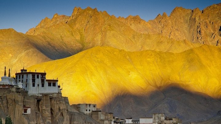
GLIMPSES OF LADDAKH
Ladakh ("land of high passes") is a region in Indian state of Jammu and Kashmir that currently extends from the Kunlun mountain range to the main Great Himalayas to the south, inhabited by people of Indo-Aryan and Tibetan descent.It is one of the most sparsely populated regions in Jammu and Kashmir and its culture and history are closely related to that of Tibet. Historically, the entire upper Indus Valley, the remote Zanskar, Lahaul and Spiti to the south, much of Ngari including the Rudok region and Guge in the east, Aksai Chin in the northeast (extending to the Kun Lun
HOLY SHRINE WITH KASHMIR
Jammu has historically been the capital of Jammu Province and the winter capital of the east, while Jammu and Kashmir princely state (1846–1952). Jambu Lochan was the brother of Raja Bahu Lochan who constructed a fort, Bahu Fort, on the bank of river Tawi. The city name figures in the ancient book Mahabharata. Excavation near Akhnoor, 32 kilometres (20 mi) from Jammu city, provides evidence that Jammu was once part of the Harappan civilization. Remains from the Maurya, Kushan, Kushanshahs and Gupta periods have also been found in Jammu. After 480 CE, the area was dominated by the Hephthalites and ruled
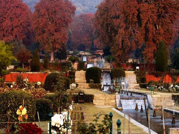
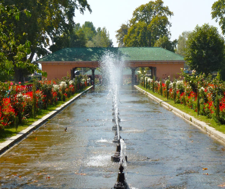
CHARMING KASHMIR
Kashmir is the northernmost geographical region of South Asia. Until the mid-19th century, the term “Kashmir” denoted only the valley between the Great Himalayas and the Pir Panjal mountain range. Today, it denotes a larger area that includes the Indian-administered territory of Jammu and Kashmir (subdivided into Jammu, Kashmir, and Ladakh divisions), Pakistani-administered territories of Azad Kashmir and Gilgit-Baltistan, and Chinese-administered territories of Aksai Chin and the Trans-Karakoram Tract. In the first half of the 1st millennium, the Kashmir region became an important centre of Kambojas and later of Buddhism; later still, in the ninth century, Kashmir Shaivism arose. In
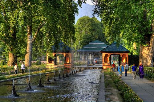
HIGHLIGHTS OF KASHMIR
Kashmir is the northernmost geographical region of South Asia. Until the mid-19th century, the term "Kashmir" denoted only the valley between the Great Himalayas and the Pir Panjal mountain range. Today, it denotes a larger area that includes the Indian-administered territory of Jammu and Kashmir (subdivided into Jammu, Kashmir, and Ladakh divisions), Pakistani-administered territories of Azad Kashmir and Gilgit-Baltistan, and Chinese-administered territories of Aksai Chin and the Trans-Karakoram Tract. In the first half of the 1st millennium, the Kashmir region became an important centre of Kambojas and later of Buddhism; later still, in the ninth century, Kashmir Shaivism arose. In
MYSTEIC HIMACHAL PRADESH
Great Himalayas ‘Himalayas in Himachal’ or one must say Himachal in Himalayas. ‘Him’ in Hindi literally means ice or snow and ‘alaya’ means home, which makes Himalayas ‘The Home of Snow’ and from there Himachal gets its name meaning ‘Land of Snow’. The Himalayas affect the climate of Himachal as well. Huge variations in the elevations of mountains (from 450m to 6500m) cause big differences in climatic conditions. Different climatic conditions according to the elevations are: 450m-950m - Hot & Sub-Humid Tropical 900m-1800m - Warm 1900m-2400m - Cool 2400m-4800m & Above - Cold Alpine & Glacial The Himalayas, fulfilling its
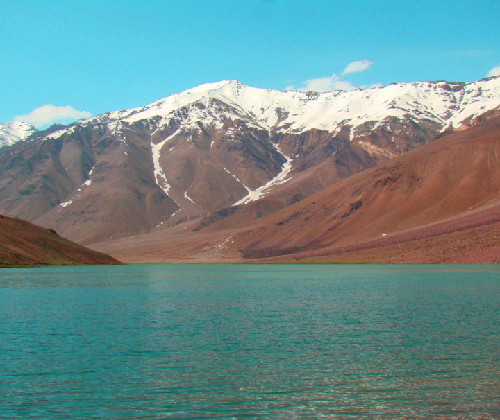
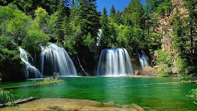
LAND OF FAITH (CHANDRA TAAL LAKE)
Chandra Tal is also known as "Moon Lake" Chandra Tal Lake is situated at a height of 4300 m and 6 km away from the Kunzum Pass in Lahaul & Spiti district of Himachal Pradesh . Boasting of a circumference of about 2.5 km, The color of water of this holy lake keeps changing from reddish to orange to blue to emerald green as the day ends. Chandra Tal Lake is the source of the Chandra river.
ROMANTIC HIMANCHAL
Shimla Manali is the hottest combination for both married and unmarried couples. As a leading India tour operator providing all travel and tourism services, the leader of tour packages in India, designed the Shimla Manali tour packages, Shimla tours, Manali tour, Shimla-Manali honeymoon tour packages, tour and travel package to Shimla Manali India, hill station tours packages Shimla-Manali, vacations packages for Shimla-Manali to view the famous attractions of Summer Hill, Chadwick Falls, Himachal State Museum, Sankat Mochen, Viceregal Lodge, Jakhoo Hill, Glen Forest, Tara Devi Temple and St. Michael's Cathedral etc. in Shimla whereas Hadimba Temple, Manikaran, Arjun Gufa, Solang
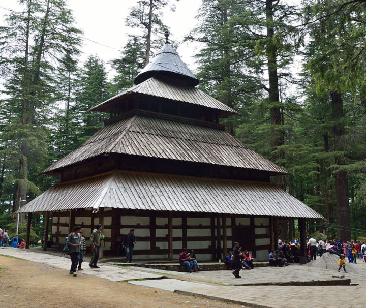
ENCHANTING HIMANCHAL
Manali is named after the Sanatan Hindu lawgiver Manu. The name Manali is regarded as the derivative of 'Manu-Alaya' which literally means 'the abode of Manu'. Legend has it that sage Manu stepped off his ark in Manali to recreate human life after a great flood had deluged the world. Manali lies in the North of Kullu Valley. The valley is often referred to as the "Valley of the Gods". Old Manali village has an ancient temple dedicated to sage Manu. The British introduced apple trees in the area. The first apple orchard was set up by the British near
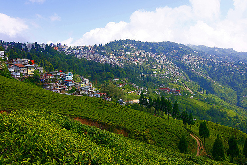
GOLDEN TRIANGLE NORTH EAST
Sikkim is the 22nd state of India came into existence with effect from 26th April, 1975. Sikkim has been divided into four districts and each district has further been bifurcated into two sub-divisions for administrative purpose. Sikkim state being a part of inner mountain ranges of Himalayas, is hilly having varied elevation ranging from 300 to 8540 meters. But the habitable areas are only up to the altitude of 2100 mtrs. Constituting only 20% of the total area of the state. The highest portion of sikkim lies in its north west direction. A large number of mountains having altitudes of