LADAKH:-Ladakh is in North east of India, neighboring Tibet a beautiful part of Jammu Kashmir. Surrounded by the Karakoram and Great Himalayan Ranges, it is a high altitude desert land and therefore sheltered from the rain bringing clouds of the Indian monsoons. Once a lake covered Ladakh and the leftover today are the 3 lakes of Tso Moriri, Tso Kar and Pangkong Tso. The main source of water in Ladakh are the winter snow falls. Ladakh has only two entries by Road, One is via Srinagar Over Zodgela Pass & another is via Manali over five highest pass, between 3500 mts to 5500 , mts. The people of Ladakh are Buddhists and Muslims. The first inhabitants of Ladakh were most probably a mixture of nomads, which wandered the Tibetan high plateau, and some early Buddhist refugees from northern India, called the Mons. In the 7th century the Buddhism from India was brought to Ladakh by the wondering sage Padmasambhava and gradually displaced the shamanic cult of the Bons. With His Holiness the Dalai Lama as its head, Gelukpa or Yellow Hat is now the most popular school of Tibetan Buddhism in Ladakh.
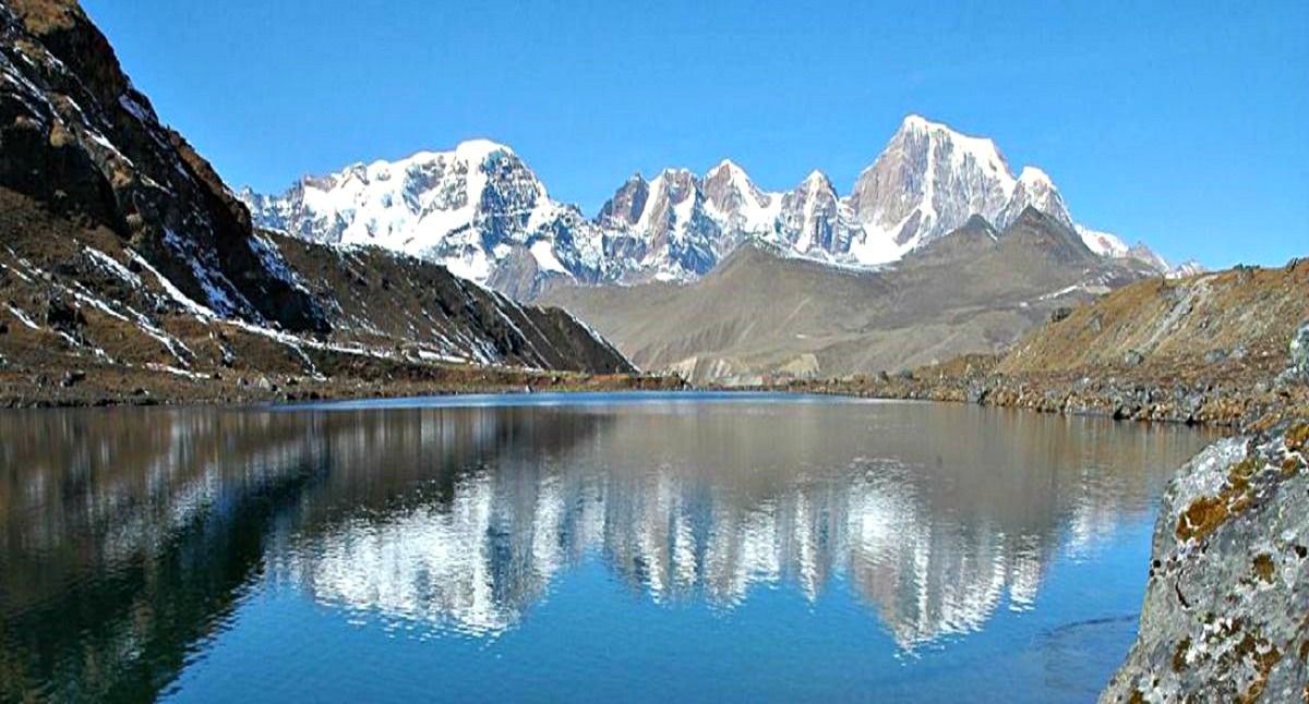
THE NUBRA VALLEY:-The Nubra Valley once on the trading route that connected eastern Tibet with Turkistan via the famous Karakoram Pass has been opened recently to the tourists. The Nubra Valley literally means the valley of flowers. Nubra Valley is situated in the north of Leh. The average altitude of the valley is about 10,000 feet above the sea level. The Khardong village, Khalser and Deskit are the main villages of Nubra valley. At first glance, the valley seems parched and dry, but this is prime farming land by Ladakhi standard. Here the farmers grow apples, apricots and barley and harvest the orange berries of the Tsetalulu. Dotted around the valley are ancient gompas and ruined palaces and villages are close enough together to make this magnificent walking country. The main attraction of the Nubra valley is Bactarian Camels (double hump Camel. PANGONG LAKE:_Pagong Tso means long, narrow, enchanted lake in the Tibetan language. It is situated at the height of about 4,350m, and measures nearly 134 km in length, though, at its widest it is just 5 km. Despite the fact that the lake is full of brackish water, it freezes to a depth of several meters in winter season. The lake changes in color during the day, appearing deepest hues of blue when the sun is high, a turquoise shade near the bank and deeper hues in the middle of the lake. It loses its shades and turns dull as the day progresses with the sun moves towards the horizon.
DAY 01: ARRIVE –LEH (3500 m)
DAY 02: LEH -SIGHTSEEING
DAY 03: LEH –PANGONG-LEH
Leave early morning at 5AM to Pangong Lake through Changla pass 5486 Mtrs. While ascending Changla pass 5486 Mtrs. Enjoy the beautiful panoramic view of the villages below the pass. After crossing the pass halt for picnic lunch at Tsoltak, the summer pastureland of the yaks. Arrive Durbuk and from there a short drive takes you to the western shore of the lake. Enjoy the landscape in the back drop of the Lake. This famous blue brackish Lake of Pangong is 5/6 Kms wide and over 144 Kms long with half of its running the other side of the “INDO CHINA BORDER”. Shared by two countries India (25%) & China (75%), Enjoy the beauty of lake on Banks of the Lake while appreciating the changing colours of fascinating high Altitude Lake. One rarely feels so close to nature and environment and the scenery is unforgettable. Drive back to Leh. En route take a short halt at Changla Pass to enjoy a cup of hot steaming tea. Overnight stay in Leh Hotel.

Tour Reviews
There are no reviews yet.
Leave a Review